South Africa’s nine provinces (States in South Africa) are Gauteng, the Free State, Gauteng, KwaZulu-Natal, the Northern Cape, Limpopo, Mpumalanga, the North West, the Eastern cape and the Western Cape.
South Africa, often called the “Rainbow Nation” due to its diverse cultures and languages, stands as a beacon of diversity not only culturally but also in its geographical and administrative makeup.
According to latest estimates from the United Nations Population Division, South Africa is the sixth most populous country in Africa, ranking number 24 in the list of countries (and dependencies) by population, with a population of about 60, 414,495 as of the year 2023.
With its rich history, stunning landscapes, and vibrant cultures, South Africa offers a unique blend of natural beauty and complex political structure that fascinates locals and visitors alike.
Unlike many countries divided into states, South Africa is segmented into nine provinces, each with its government (Legislature, Premier, and Executive Council), capital city, history, landscape, population, languages, economy, cities, and distinct identity.
These provinces were redefined in 1994, following the end of apartheid to better reflect the country’s diverse cultural and linguistic heritage and to promote equal economic development.
This guide discusses South Africa’s political geography, shedding light on the states in South Africa and capitals, and their leaders.
Before Nelson Mandela took office as president in 1994, South Africa had four major provinces: Transvaal, Cape of Good Hope, Natal, Orange Free State, and 10 “homelands” (also known as Bantustans). The homelands belonged to black people, whereas the four more prominent districts belonged to white people.
After South Africa’s 1996 adoption of a new constitution, this structure was abolished and divided into nine provinces. These provinces include:
READ ALSO: 23 Best Places To Hangout In Ibadan In 2024 & How Much It Costs

| S/N | Province in South Africa | Capital | Premier (Leader of Government) | Area (Square Kilometers) | Population |
| 1 | Eastern Cape | Bhisho | Oscar Mabuyane | 168,966 km2 | 6,734,001 |
| 2 | Free State | Bloemfontein | Sisi Ntombela | 129,825 km2 | 2,928,903 |
| 3 | Gauteng | Johannesburg | David Makhura | 18,176 km2 | 15,488,137 |
| 4 | KwaZulu-Natal | Pietermaritzburg | Sihle Zikalala | 94,361 km2 | 11,531,628 |
| 5 | Limpopo | Polokwane | Stanley Mathabatha | 125,754 km2 | 5,852,553 |
| 6 | Mpumalanga | Nelspruit | Refilwe Mtsweni-Tsipane | 76,495 km2 | 4,679,786 |
| 7 | North West | Mahikeng | Job Mokgoro | 104,882 km2 | 4,108,816 |
| 8 | Northern Cape | Kimberley | Zamani Saul | 372,889 km2 | 1,292,786 |
| 9 | Western Cape | Cape Town | Alan Winde | 129,449 km2 | 7,005,741 |
Related: 36 States and Capital in Nigeria and their Governors 2021 Update
States in South Africa, Capitals and Leaders
1. Gauteng

Often referred to as the economic engine of South Africa, Gauteng is the most populated province while having the lowest geographical area, occupying 18, 178 km², or 1.4% of the country’s total surface area and home to 15,810,388 people in 2021, which is 24.1% of the national population.
Its capital, Johannesburg, is the largest city and the economic hub of the province and arguably the entire African continent.
The province is currently led by Premier Panyaza Lesufi, who took office in 2022, aiming to tackle the region’s challenges, including unemployment and infrastructure development.
2. Western Cape

Known for its breathtaking landscapes and the iconic city of Cape Town, the Western Cape boasts a diverse economy and a flourishing tourism industry. Cape Town, the provincial capital, is a top tourist destination and a center for innovation and entrepreneurship.
Among the states in South Africa and capitals, the Western Cape covers an area of 129,462 km2 and has a population of 7,426,673 as at 2022. It is the fourth-largest province in South Africa by surface area and ranks third in population.
Alan Richard Winde has been the Premier, since 2019 till date, focusing on enhancing public services and boosting the local economy.
3. KwaZulu-Natal

With Durban as its capital, KwaZulu-Natal is renowned for its rich history and stunning coastlines. The province plays a crucial role in South Africa’s manufacturing and agriculture sectors, covering an area of 12,417,210 km2.
Being among the States in South Africa, the 2022 Census results showed an increase in the KwaZulu-Natal population by 21% between 2011 and 2022, having a population of 12,417,210 . This province is headed by Premier Nomusa Dube-Ncube (ANC).
4. Eastern Cape
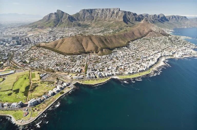
Situated between the provinces of KwaZulu-Natal and the Western Cape, the Eastern Cape is a region on South Africa’s east coast. Home to Bhisho, the capital city, it is governed by Premier Oscar Mabuyane.
From the semi-arid Great Karoo to the forests of the Wild Coast and the Keiskamma Valley, the fertile Langkloof, and the mountainous southern Drakensberg region, the Eastern Cape is renowned for its natural beauty and cultural significance.
The stunning Indian Ocean coastline that borders the Eastern Cape is its most notable feature.
It’s a key area for the automotive industry and agriculture. It covers an area of 168 966km² with a population of 7,225,784 as of the year 2022.
5. Northern Cape
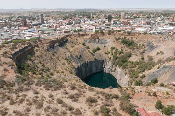
In discussing the states in South Africa and capitals,the vast and dry Northern Cape is the largest province in South Africa. It covers an area of 372 889km² taking up nearly a third of the country’s land area. while Kimberley serves as its capital.
Rich in minerals, and known for its mining industry and astronomical observatories, the province is quite thinly populated, with a population of 1,355,629 in 2022.
It is bordered by Namibia and Botswana to the north and also by the North West, Free State, Eastern Cape, and Western Cape provinces. The cold Atlantic Ocean forms the province’s western boundary.
Other important towns are Upington, Springbok, Kuruman and De Aar, the second most important junction of South Africa’s railway network.
6. Free State
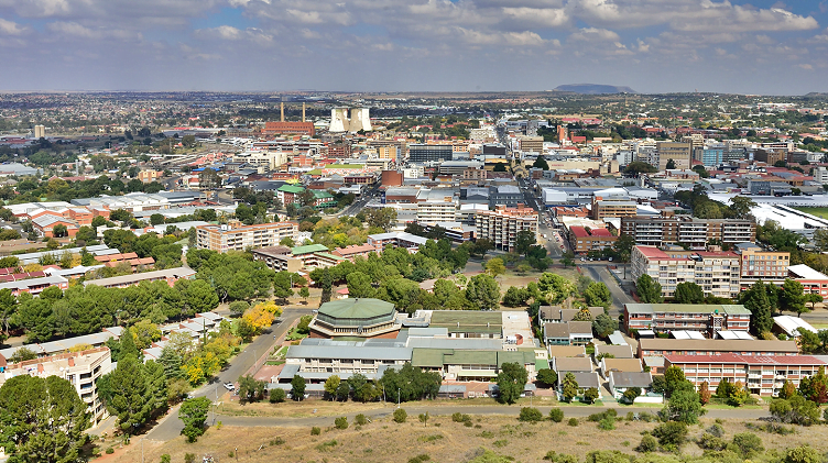
Headed by Premier Sisi Ntombela and situated in the geographical center of South Africa, the Free State is surrounded by the provinces of Mpumalanga, KwaZulu-Natal, Gauteng, Lesotho, the Northern and Eastern Capes, and the North West.
The Free State is a rural province of farmland, mountains, goldfields, and widely dispersed towns.
Although the Free State is the third-largest province in South Africa, it has the second-smallest population and the second-lowest population density. It covers an area of 129 825km² and has a population of 2,961,864 according to the 2022 census.
Its capital is Bloemfontein, which is South Africa’s judicial capital. Other prominent towns include Welkom, Kroonstad, Sasolburg, and Bethlehem.
The province is the world’s fifth-largest gold producer among the lists of states in South Africa and capitals, with mining as the major employer, followed by manufacturing, and agriculture.
Approximately 90% of the province is used for grain production, earning it the nickname “bread basket” of South Africa.
It produces approximately 34% of the total maize production of South Africa, 37% of wheat, 53% of sorghum, 33% of potatoes, 18% of red meat, 30% of groundnuts and 15% of wool.
7. North West
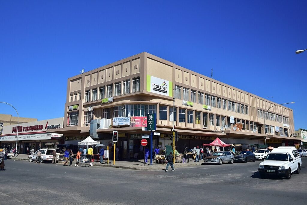
North West is located on the Botswana border, north of South Africa. It is bounded to the west by the Kalahari Desert, to the east by Gauteng Province, and to the south by the Free State. With a population of 3,803,679 in 2022, it has an area of 104 882 km².
A large portion of the province is made up of grassland and level plains with sporadic trees. The capital is Mahikeng (formerly Mafikeng).
The city and its neighboring settlement, Mmabatho, form a unified urban region close to the border with Botswana.
Klerksdorp and Potchefstroom are the two largest cities in the province. Brits, Rustenburg, Klerksdorp, and Lichtenburg are some of the other major towns.
Premier Bushy Maape leads the North West province, known for its mining activities and agricultural production. It represents almost a quarter of South Africa’s mining industry, producing a quarter of South Africa’s gold, granite, marble, fluorspar, and diamonds.
It is also well known for cattle farming, while the region surrounding Rustenburg and Brits is a rich area used for mixed-crop cultivation. Maize and sunflowers are the most important crops, and the province is the country’s primary producer of white maize.
8. Mpumalanga
On the lists of states in South Africa and capitals, the second-smallest province in South Africa after Gauteng is Mpumalanga, which is situated in the northeast and has borders with Mozambique and Swaziland to the east.
In South Africa, it also shares borders with KwaZulu-Natal, Gauteng, Limpopo, and the Free State. It has an area of 76 495km² and has a population of 5,142,216 as at 2022, making it the sixth most populous in the country.
Mbombela (previously Nelspruit) is the province’s capital and Lowveld’s administrative and business center. Other major cities and towns include eMalahleni (previously Witbank), Standerton, eMkhondo (previously Piet Retief), Malalane, Ermelo, Barberton, and Sabie.
The best-performing sectors in this province include mining, manufacturing, forestry and services, and tourism, with Premier Refilwe Mtshweni-Tsipane as the current serving leader of this province.
9. Limpopo
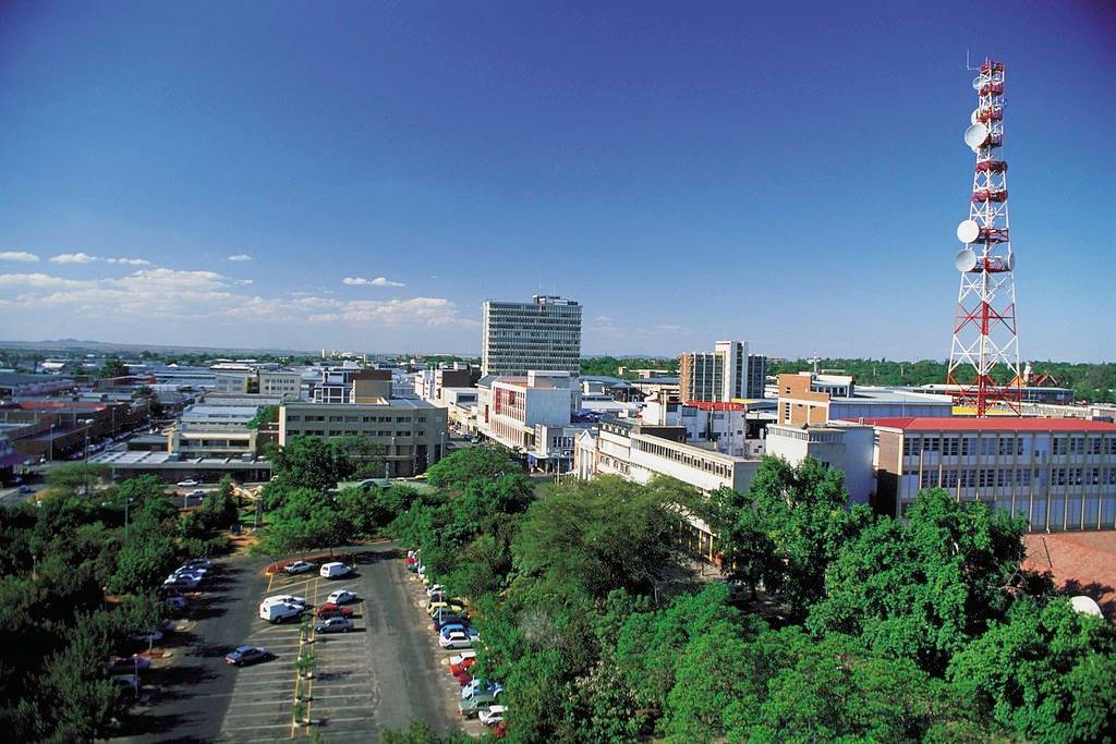
Polokwane, the capital, marks the heart of Limpopo, a province that thrives on mining, agriculture, and tourism. Leadership focuses on rural development and improving public services.
Limpopo, South Africa’s northernmost province, borders Mozambique, Zimbabwe, and Botswana. It also borders the Mpumalanga, Gauteng, and North West provinces.
Named after the Limpopo River, which flows along its northern border, it is a region of contrasts, from valid Bushveld country to majestic mountains, primeval indigenous forests, unspoiled wilderness, and patchwork of farmland.
With Premier Stanley Mathabatha as the leader of this province since July 2013, The province has a population of 5,404,868 as at 2022 and a surface area of 125 754 km², placing it fifth in South Africa in both surface area and population among the states in South Africa and capitals.
Polokwane, formerly known as Pietersburg, serves as the capital. Other significant towns and cities are Thabazimbi, Tzaneen, Lephalale (Ellisras), Makhado (Louis Trichardt), Musina (Messina), and Bela-Bela (Warmbad).
The province’s economy, agriculture, and tourism are mostly driven by mining.
Conclusion
Understanding the provinces of South Africa, their capitals, and their leaders offers a window into the country’s complex political and social fabric. Each province, with its unique challenges and opportunities, contributes to the tapestry of South Africa’s national identity.
Whether you’re exploring South Africa for its scenic beauty and history or engaging with its vibrant economy, the story of its provinces is integral to appreciating the full spectrum of what this extraordinary country has to offer.



1 thought on “List of States in South Africa and Capitals (2023 Updated List)”